
Project Shirlington
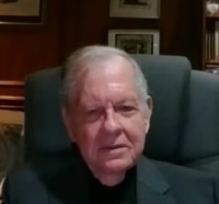
Joe Pelton
Joseph N. Pelton, Former Chairman, Arlington Co. Civic Federation, relates the events and coordination activities that led to the redevelopment of the Village of Shirlington and his involvement in the redevelopment of Shirlington following Hurricane Agnes in 1972. Pelton described how the hurricane devastated the area by washing away the bridge across Four Mile Run, creating an economic tourniquet that resulted in $12 million in lost sales over three years. He detailed the key elements of the redevelopment plan, including bridge reconstruction, flood control through rip-wrapping, creation of a berm to screen county property yards, and implementation of a mixed-use zoning ordinance.
Pelton explained how Metro construction provided additional infrastructure benefits and described the role of architect Arthur Cotton Moore in developing a comprehensive site plan for Shirlington. He also discussed the formation of the Long Range County Improvement Commission under Dr. Joe Wholey's leadership, which helped implement the mixed-use development model across Arlington's Metro stops, particularly along the Rosslyn-Boston corridor.
The interview covered how Shirlington became the first successful implementation of this mixed-use approach, featuring integrated retail, office, residential, and cultural facilities that created a balanced tax base and served as a model for similar developments elsewhere in the county.
Pelton explained how Metro construction provided additional infrastructure benefits and described the role of architect Arthur Cotton Moore in developing a comprehensive site plan for Shirlington. He also discussed the formation of the Long Range County Improvement Commission under Dr. Joe Wholey's leadership, which helped implement the mixed-use development model across Arlington's Metro stops, particularly along the Rosslyn-Boston corridor.
The interview covered how Shirlington became the first successful implementation of this mixed-use approach, featuring integrated retail, office, residential, and cultural facilities that created a balanced tax base and served as a model for similar developments elsewhere in the county.
Transcript
[00:00:06] Marty Suydam
Today's date is September 24th, 2025.
It is 10:06 in the morning. The title of this oral history is Village of Shirlington History, and I am Marty Suydam. I am the co-chair of the. Arlington Historical Society Historic Research and Preservation Committee.
I'll be doing the interviewing. And I'll now introduce Joe.
So, good morning, Joe.
Good morning. My name is Joe Pelton. I have been involved with the Shirlington Redevelopment since it began as a result of the Agnes, Hurricane.
I served on the Long Range County Improvement Commission that helped to get the mixed-use Ordinance passed in Arlington County. I was President of the Arlington County Civic Federation. I also ran for the Arlington County Board with a narrow loss in 1978.
[00:00:38] Joe Pelton
Well, good. You have good credentials. Well, let me give you the first question. How did Hurricane Agnes stir and influence the redevelopment of Shirlington?
Well, Hurricane Agnes came as quite a shock, because I was actually in Stavanger, Norway on work for Intelsat where I was involved with an international meeting.
[00:01:30] Marty Suydam
A colleague of mine who lived--actually in Maryland--notified me that the hurricane had hit all of Washington. His basement was flooded, and I needed to check on what was happening in my home in Arlington.
Well, I quickly found out that there had been devastating loss of the bridge across Four-Mile Run, very close to where I lived. I learned that Shirlington had been flooded, as well as Arlandria and that this was going to be quite a problem. I understood when I got home that the bridge had been completely washed away and that the state of Virginia had put in place a one-lane temporary Bailey Bridge across, so that traffic could get across. But there was a traffic signal, and traffic was greatly constricted, and this became a tourniquet,--an economic tourniquet-- for Shirlington because it was very hard to get access to it. After the 3 years, that followed the disaster, Shirlington sales had dropped $12 million.
This area was first started as a shopping mall and complex. That 28-acre facility opened in 1948. It featured Landsberg’s and was quite an innovative shopping center when it started in 1948. But by 1972 it was having problems, and the hurricane really made this a really big problem.
In 1974, two years after this event, and we still had the Bailey Bridge in place, I became campaign manager to Warren Stambaugh, who was running for the state delegate, for the House of Delegates in Virginia.
We decided to create a signature campaign to get the bridge rebuilt.
We collected thousands of signatures during that campaign. Stambaugh, a first-time candidate, rather surprisingly, won his election. He immediately went to work on this issue. He worked closely with Congressman Fisher who represented the. Arlington and Alexandria districts. They put together a package of $63 million to restore the area and put in flood control. $63 million may not seem like a whole lot today, but that's equivalent to $410 million in today's dollars. And there was about $50 million in support from the federal government. There was support from Alexandria and Arlington, and from the state of Virginia to get this started. And we also started talking to Arlington officials about what could be done to put together a plan for restoring this whole area that had been very hard hit by the Agnes Hurricane.
[00:01:36] Joe Pelton
What were the key elements of this plan?
[00:05:46] Marty Suydam
Well, the plan we had included at least four elements. The process to get the bridge rebuilt at least had been passed in terms of state funding for a four-lane bridge that would restore access between Arlington and Alexandria, and to Shirlington. Getting this done, and done promptly was a key part of the plan. Another part of the plan was the unsightly county property yards, and we had the idea to push for creating a berm that would screen the property yards from Arlington Mill Road. Next, we, of course, wanted flood control so that Shirlington wouldn't be regularly flooded in the future, as well as all the parts of Four Mile Run going all the way down to the Potomac. And the idea was to use rip-rapping that could widen the channel and, also, help with flooding conditions. We had the next key element, though, and that was how to get Shirlington redeveloped in a new and, if you will, economically viable way. And so what we did is we created a citizen group. And when I say we, actually, I was taking the lead in trying to get this done, because I started this effort collecting signatures in Shirlington, and I saw how much it was declining and how it was becoming a problem for the area. So we got the neighborhoods of Abington, Arlington Ridge, Alcova Heights, Barcroft Community, Claremont, and Fairlington, which was really key, because it really was closely linked to Shirlington and Green Valley (now Nauck), which was also closely linked to the Shirlington area. We went to the County Board, and we urged action, and one of the things that we supported was the idea of mixed-use Planning Ordinance, and this would allow us to put together housing, commercial businesses and office buildings, and in an integrated way for this 28-acre site.
I became very much involved in this exercise. This was now 1975. I was at that time, elected president of the Arlington County Civic Federation. And my efforts and those of my colleagues, I think, led in part to my being elected President of the Civic Federation.
As I understand it, Metro had a big impact on this as well. How did the building of Metro add to the redevelopment.
[00:05:49] Joe Pelton
Well, the interesting thing is that the excavation for Metro, and particularly the excavations going under the river, produced a tremendous amount of rock that had to be dynamited out. And then put somewhere. And so we met Arlington County planners, and our group said this would be a good way of doing the flood control along Four Mile Run. And that we could use this stone for so-called rip-rapping to widen the channel and make it more secure against future floods. Also, we could use that stone to screen the property yards to build the screening berm. It turns out that we were able to use some of that to level the ground and create the so-called Jennie Dean Park.
I got to know Jennie Dean rather well during my campaign for the County Board. I worked with John Robinson and a number of leaders from the Green Valley (Nauck) neighborhood during my campaign. And so this set the stage for trying to get these plans to redevelop Shirlington in place. And it also led to county officials thinking about how we use this process to reinvigorate Shirlington as a part of a whole new complex of buildings that we might put in place. And eventually there was the Animal Control Building put in place the Barcroft Field Recreational Area, and associated buildings, and the Virginia DMV offices. And this helped to restore and put new infrastructure in the areas all along Four Mile Run.
You've made a lot of history, or covered a lot of history so far. What is the role that Arthur Cotton Moore, who is an architect, play in the redevelopment.
[00:09:05] Marty Suydam
Well, I knew Arthur Cotton more from his works to redevelop and reuse buildings in new and creative ways in the Georgetown area of DC. And a number of other projects that he did and through a friend who I knew quite well from the satellite industry, who knew Arthur Cotton Moore, we approached him and said, could you develop a new conceptual plan for Shirlington? Also, at the time, I had moved to Columbia Pike, and asked him if he could you come up with some better plans for the Columbia Pike redevelopment as well? He not only agreed, he did much more than we thought that he would be able to do. He developed a full site plan for Shirlington, for the whole area and he started with the idea of taking the Best Buy building, which had taken over the Landsberg facility, and turned it into a mall with lots of little shops and skylights, and basically re-envisioning that building. He envisioned a lake. It was a very sculpturally designed lake that also had a function, and that was it could be a drainage area to take in floodwaters in case there was another flood condition. He envisioned a 15-story apartment building, recreation facilities, a skating rink, and tennis courts, and the whole idea of shops, restaurants, office buildings, apartment buildings, if you will. The whole plan was based on the whole mixed-use planning ordinance that was key to his ideas of how you create a community that was integrated with the people who lived there, the people who worked there and the shopping area as a magnet to draw customers. His vision, if you will, was to create a more viable plan for the future, for this area. He also did a plan for Columbia Pike. He had the innovative idea to address the problem of all of these wires above ground that were rather unsightly. The idea was that you could put these wires down into compact little utility conduits that would run along the curb. He also envisioned that you could put various banners and pennants along the Columbia Pike. He even considered the idea that Columbia Pike could be made into a one-way facility, and that another roadway could be created a block the other side of the Pike to the South. If this was done to open up the corridor to more traffic, if you will, some sort of rapid transit or bus lanes could be added. This became very key later on when I was on the Long-Range Planning Improvement Commission in the process to decide where we would put the metro stops. The issue became whether to put the metro stops along Wilson Boulevard, or would we put them along Columbia Pike, which had the highest density in terms of apartment buildings? By this time had moved on and I was actually into campaign mode, running for County Board race and I campaigned on the issue of the need for commercial redevelopment of Columbia Pike, Shirlington and also the so-called Parkington area, which now is known as Ballston.
Well, you mentioned the Arlington County Long Range Improvement Program. How did that commission impact the redevelopment and the mixed-use zoning and routes of the metro. You were beginning to describe this, you know, the narrow roadway, that type of thing, with Columbia Pike. So, can you add a little to that?
[00:09:12] Joe Pelton
Well, this Commission was really the brainchild of a county board member, Dr. Joe Wholey. He worked at the Urban League, and he had a whole lot of interesting ideas about what could be done. He worked closely with Joe Fisher who was the county board member who went on to be a U.S Congressman. And Joe Wholey put together a I think it was 7 or 8 members, and I, as president of the Arlington County Civic Federation, was designated to be a member. I was also the youngest member of this group, but I tried to do my best to help with the planning process. And one of the key issues was where to put the Metro stops in Arlington. And it turns out that, through a lot of good planning, effort we decided on Wilson Corridor route was most viable. Jt was finally decided that there would be 11 stops for Metro in Arlington. Which was the most stops per area of any jurisdiction in the area, even more in terms of density than the District. And the key issue was, do we put this routing along Columbia Pike, where there were a whole lot of apartment buildings and density, or, do we make this a tool for urban planning and renewal of Arlington. And eventually, it was decided, after much back and forth--and frankly, I was initially on the side of Columbia Pike--that, no, this would be a great tool for reinvigorating what became known as the Rosslyn-Ballston (RB) Corridor. This was an area where it would be possible to put a series of Metro stops where we could put density. And thus this led to the idea that would be the optimum area where to create Bullseye density around each stop. The greatest density would be right at the center of the bullseye, where the metro stop was. This was where we would put high-rise apartment buildings, office buildings, and also a significant amount of retail commercial businesses. So, eventually it was decided, that we would do this, but a critical, and quite key element of this was to say, let's make this not only a transportation corridor and a facility driven redevelopment, but let's use the mixed-use idea as well. This was so that we would have these areas to be available almost 24 hours a day, certainly a 16-18 hour day where people would go to work, where people would live, and where people would shop. And, these metro stops would be a magnet for people to be involved with the Arlington community, and that these would be very walkable types of redevelopment areas. And so, eventually this issue was resolved.
There was certainly, at this time, a bit of the South Arlington versus North Arlington issues. At the time it seemed like the wealthier people lived in North Arlington and the South Arlington part didn't get as much resources and attention. And so, this Planning Commission tried to say, let's try to solve all of our problems. Let's create master planning for transportation, for housing, for environment and, parklands and so on.
[00:11:32] Marty Suydam
And eventually that grew to cover a number of other things, including information systems, and this is where I was, very much involved in creating the Advisory Commission on Information Technology. And, in that role, I also participated in the creating of a master plan for renewable energy, and how to optimize green energy use, and solar and other types of economically and environmentally interesting energy technologies. So, I really credit Joe Wholey for being the master planner who saw the potential of mixed-use zoning and of using this, not only for Shirlington, which was the first application, but also for all of the Metro stops which essentially were eventually implemented at these stops. These key decisions have become an important source of revenues, tax revenues, and it has worked very well. To the extent that, at a national level, and even international level, city planners come to study exactly how this was done in Arlington. These were the various elements that went together in terms of the master planning, in terms of the bullseye development, the moving from the high density down to the neighborhoods about a quarter of a mile away from the stop.
You've already mentioned this mixed use, and how did the mixed-use zoning ordinance impact the metro stops and the Metro development?
[00:11:45] Joe Pelton
Well, certainly, this approach to zoning was truly key. With Mixed-Use zoning you gained so much more flexibility in the planning around the Metro Stop areas. With traditional zoning you had office building zoning, and then you had commercial retail zoning, and then you had zoning for apartment buildings and condos, and various types of residential zoning categories for other areas of the County, For the most part, these were not integrated, and Joe Wholey was clearly the leader to say this doesn't make sense, particularly in the areas where you have a Metro system,. There you can integrate different types of uses where density makes sense around these metro stops. This is where to encourage density. And you can also integrate them in such a way that people can live and work and shop in a kind of a little village around each one of these Metro stops. And so the transportation planning, and ultimately, the energy and the renewable energy and broadband information services planning as even the economic and taxation planning all could go together, and certainly this blossomed in the RB corridor. That's the Rosslyn to Ballston corridor. But it also was planned and was implemented for Crystal City, Pentagon City and in the south part of the of the county. Frankly, it was ultimately much more of a success along the RB corridor than it was with regard to Crystal City, Pentagon City, and the other developments, which tended to be not as well integrated.
But this probably could not have worked for Columbia Pike because of all of the really heavy density of apartment buildings already there in place. And so you couldn't really have achieved that same sort of village development along, Columbia Pike, that you could, where you were sort of starting anew with the metro development along Wilson Boulevard. So, as I say, I first thought we should do it along Columbia Pike. But under Joe Wholey's leadership and analysis, I agreed that, no, this new development in this new bullseye type of development should be encouraged and could be a renewal for the entire county. And that's what happened. It didn't, however, necessarily work for all of the stops initially, and maybe we can go to that.
Well, you mentioned Rosslyn and Crystal City Metro stops were initially failures. What do you think about that?
[00:16:03] Marty Suydam
Well, that's perhaps too harsh of a word, but the point is, Rossalyn and Crystal City had already started its development, and it was largely the traditional office building complex. These two areas were initially conceived of before the Metro development, and mixed-use planning had been put in place. So, these two areas were sort of concrete canyons at first, because they were largely office buildings, and they didn't have the other commercial, retail businesses in the mix and didn't have the living facilities there as part of the mix. And so, it was decided, we have to do something to make these areas more like a village, and so they, passed funding to build walkways, to let pedestrians move better along the areas, and there was, again, the active implementation of the mixed-use concept that was brought into play. And so, Rosslyn and Crystal City were partially transformed to become much more of a community and an integrated facility that did have grocery stores and restaurants and condos and apartment buildings, and all of the other types of things that mixed use allowed to make them more of a 24-hour-a-day community and less of a concrete canyon of office buildings, where it was very difficult for pedestrians to get around. So, they were never completely transformed, but the County Board recognized that they needed to do something to make them more of a mixed-use facility, and to be more friendly to pedestrians and to create this integrated mixed-use model that was largely achieved along the RB corridor and along the South Arlington community Metro corridor, but to a lesser extent.
You mentioned about Shirlington, and you've also brought up the smart planning model. What is the story about Shirlington as the first mixed-use stop?
[00:16:26] Joe Pelton
Well, the thing is we leveraged significantly the Arthur Cotton Moore development model and the whole idea of a mixed-use facility, and so on.
And the people who owned Shirlington brought in their own planning team, and actually, they came up with a more integrated and intensive use model than Arthur Cotton Moore had developed. They really did see we can put in this 28-acre site a lot of retail, particularly restaurant, We can put in office buildings, and we can put up high-rise condos and apartment buildings, and also, we can encourage the county to screen off the property yards. And so they came up with a plan to create a real village area. in fact, it all came together, the bridge had been restored, the rip-rapping had been done, the park was then done along Arlington Mill Road, and these various buildings were built, and the restaurants, that developed along the central entrance to Shirlington were thriving. This stretch is now known as Campbell Avenue in honor of Elizabeth Campbell, who was the founder of WETA Television and Radio. She and Ed Campbell, who did so much for Arlington, were supporters of this redevelopment of Shirlington and also supported me during my County Board election race at their home. Over time, people really did think of this not so much as the Shirlington Shopping Center, but what became officially known in 2000, as the Shirlington Village. County planners and the County board essentially just kept building on that concept. So, they came up with the idea of putting together the new Signature Theater along Campbell Avenue and integrate it with a new library development. So they had a building that was half the Shirlington Library and half a theater facility with a major theater with a large amount of seating plus a black box theater. And this also became a part of the village. The woman who started WETA, Elizabeth Campell, also became very much involved with this planning process and so WETA moved from their sort of shoddy facilities into a new modern building in Shirlington. Shirlington became really a model for how you could put all of these factors together into an integrated way of not only office buildings and living facilities and retail, but also cultural facilities as well. And so, this is really key, not only in terms of a good way, to put together density and transportation facilities and so on. Shirlington was not at a Metro stop but express buses to the Pentagon Metro stop were developed. Shirlington also became a key part of Arlington's economic tax base, because it has now created a well-balanced source of tax income from businesses and commercial office buildings, and commercial retail, particularly restaurants and restaurant taxes and finally taxes from property from the various condos and apartment buildings and what have you, and so, there's kind of this 50-50 split between real estate tax and commercial tax income that allowed Arlington to weather the very adverse effects of the COVID-19 pandemic. And then also the impact of the Defense Department’s National Defense Base Realignment Study, where they moved a lot of facilities and services out of Arlington, which was very heavily impacted. And that not only took the Defense related activities out of Arlington, but also all of the big aerospace companies that were associated with it. And so, this strength of mixed-use development model is not only good in terms of what I would call security in terms of a lively community many hours of the day where there is activity on the streets during the day and evenings, but also economically, in terms of having a balanced source of tax income, and so on. So, people sometimes, when they look at this, they forget these other elements of the transportation efficiency of putting density at the Metro stops. The energy efficiency of putting a house, facilities together that are energy efficient. And, the tax revenue that comes from, again, this mixed-use type of development.
Well, now you focused on the buildings and that type of thing, but what other positive elements flowed from these efforts like, Four Mile Run? You know, waterway control, things like that.
[00:23:01] Marty Suydam
Well, certainly, again, the rip-rapping from Metro allowed a cost-effective way to create a whole new corridor that benefited not only Arlington, and the southern part of Arlington, but also Alexandria, and especially the Arlandria areas of Alexandria, which was severely flooded by Hurricane Agnes. And so this redevelopment, and the rip-rapping process also led to new parkland and open space, because, in many areas, they basically tried to create parkland in flood zone areas and thus to try to move housing out of flood areas right along Four Mile Run. And now, you know, in terms of integrated park facility, one can start at where Four Mile Run flows into the Potomac and walk along a park-way that goes all the way not only up to Shirlington and along Arlington Mill Road, but, then connects to a series of trails that goes all the way to the Shenandoah and Blue Ridge Mountains. And, here, I will note, you as an authority on this, and how these integrated park areas were really envisioned, very early on. But now, the Shirlington and the Four Mile Run redevelopment has served to enable part of that trail system that goes 60 miles or more from the Potomac to the Blue Ridge. And then, there's the transportation aspect of it that we have created along the Arlington Mill Road area. A whole series of new developments there in the area just on the other side of the Shirlington Shopping Center that was undeveloped. There was some thought about trying to save it as an open space. But the county zoned it for townhouses. This became kind of an integrated part of the Shirlington development. And then, as I mentioned earlier, there was the Barcroft Recreational area and building facilities, the DMV building, and the latest installation that the County has brought to this stream of facilities is the Arlington Mill Community facility and Retirement Housing that's now a facility for people needing retirement housing and a community center. This is now a part of the Columbia Pike Redevelopment Planning effort.
Finally, there was something else that I was involved with involving Shirlington. This stemmed from the Information Technology Advisory Commission. We supported the creation of a fiber ring around Arlington to connect Arlington County facilities, Arlington schools, and also our Arlington businesses facilities. This fiber ring is something that can provide additional capacity to businesses. And again, while I was chairman of the IT Advisory Commission, I helped to get the extension of that fiber optic ring into Shirlington. There was, you know, some architectural issues and problems, and we finally got the owners of Shirlington to agree that this was an additional aspect of the Shirlington Village that was important, and we and Country staff made that happen as well. So, in terms of communications, transportation, urban planning parklands and so on, the Shirlington became kind of the core element from which all of these other amenities flowed.
Yes, when I wrote “Walk Four Mile Run,” I spent a couple years, traipsing through all of those areas, and you brought back a lot of thoughts on that. But, you know, Shirlington is right along this Four Mile Run, right along the border between Alexandria and Arlington. What about Alexandria-Arlington Collaboration?
[00:23:12] Joe Pelton
Well, as I mentioned earlier, that we formed this coalition. And that we got, the Fairlington community involved in this process, and there were a number of people who were very actively involved in supporting this development. And the Fairlington community is now restored very much like Shirlington. This neighborhood cuts across the Alexandria, Arlington border. Shirlington Redevelopment and the access. to the freeway is very key in its planning, in that there is a circular access development so that people can from Fairlington easily drive, not have to get on the freeway, but just go around the circular access that provides easy access on multiple ramps. There are multiple ways to, drive right into Shirlington from Alexandria. And so, this is a key element of that integration, but as I noted earlier, that Arlington and Alexandria contributed to the flood control plan, the $63 million flood control fund that let the rip-rapping and the flood control system go all the way from the Shirlington area down to the Potomac included money from both Alexandria and Arlington. Arlington and Alexandria have a history of cooperative development, and this is certainly one of the key. Elements that I personally have seen in several ways. When we were trying to do our hearings on the cable TV industry and the renewal of the franchise and also the development of the fiber ring. We coordinated very closely with the Alexandria officials to see what they were doing in this area, and to see whether these systems could be potentially interconnected together. We sought to avoid problems of interconnection, or problems with these kinds of infrastructure development between the two jurisdictions. Since some neighborhoods cross the border we coordinate police, fire and ambulance service as well. This was one of the topics addressed by the IT Advisory Commission when I was chair—also IT system security practices..
So, I think that Shirlington was certainly one that the Alexandria City Council followed very closely. They understood that the flood control system required cooperation. Also, the four-lane bridge across Four Mile Run on South Walter Reed, is an important connector between Arlington and Alexandria. And that Shirlington is in many ways, a really important, you know, indicator of how, Arlington and Alexandria can work together. And, as I say, the Fairlington community, which went, across the border was very strongly supportive of this. When I ran for election in 1978, I won the Fairlington Precinct by 2 to 1 and, so that was, you know, part of the South Arlington community speaking about that they wanted more support, and that they really appreciated the Shirlington redevelopment.
Great. You had earlier mentioned about the Arlington Mill Drive development, the berm, parks, townhouses. Can you tell more of the story of that?
[00:26:48] Marty Suydam
Well, the key, of course, was two things. One was the bridge that I frankly think should be called the Stambaugh-Pelton Bridge, because we really made it happen. And the rip-rapping and the flood control and this really set the stage for a whole lot of different things that happened afterwards.
The Shirlington Village, which today is a tremendous economic success and the place where people from all over the county go to eat, and where communities go to the theater and what have you and so that, new library and the Signature Theater is a cultural part of the whole South Arlington community. But, we also have the townhouse complex that's sort of an extension of Shirlington and then going further down, we have the Barcroft Recreational area, which is one of the biggest recreational facilities in the county the DMV facility, the other parkland areas. Again, as I mentioned, you can walk along this area all the way to the Shenandoah. And then, the latest thing is this Arlington Mill community center, and also a senior citizen residents. So this area is really anchored by Shirlington, but it has grown like an amoeba along The Four Mile Run corridor on Arlington Mill Road. to include a wide number of county and state facilities. And of course, a great parkland and recreational area. And this I think really came out of a whole lot of citizen effort and concerns. But I would note that there were a number of key players who made this happen. Joe Wholey, I mentioned earlier was at the Urban League, and he and Joe Fisher. Both of these were exceptional leaders, both with PhDs and a lot of foresight who made the long-range County Improvement Commission work to transform the whole character and development of Arlington, through the mixed-use approach to the metro stops. Frankly, I'm the only surviving member left. Certainly, Warren Stambaugh put in tremendous effort to get the Four Mile Run bridge restored, and get the County to move ahead with the Shirlington redevelopment. Another person that I would just, recognize is Herman Obermeyer, now deceased. He was the editor and publisher of the Northern Virginia Sun. And he took a real interest in what we were doing there. And he made the May 22nd Issue of the Northern VA Sun was almost all about the Arthur Cottom Moore plan and our efforts to redevelop Shirlington and the Mixed-Use Zoning Ordinance. I think it was May 1975, when he put in editorial endorsing what we were doing and an expressed strong support for the mixed-use ordinance effort and Shirlington Redevelopment effort. He actually ran a full spread of what the plan developed by Arthur Cotton Moore would look like and showed the key elements of how he would transform the Best Buy building facility and other elements of the redevelopment. And certainly his support and major stories and endorsements of what we were doing was a very important part of the story, from my viewpoint as well.
[00:26:55] Joe Pelton
And of course, another key player in all of this is Joe Pelton. You've painted a great picture with your words of how all of this changed, and as much time as I've spent and lived in Arlington and Alexandria. I didn't know half of what you brought up here. There was real planning and genius that made that area. It just didn't happen.
So, this last hour that we've spent, I think is a great contribution and also, a testimony to your legacy as well. So thank you, Joe, for your time and your contributions over many years.
[00:29:38] Marty Suydam
Well, thank you for doing this. I thank the Arlington Historical Society.
It has played a very key role in preserving the history of Arlington. I know a number of key people who have preserved various parts of the story, and I'm glad that this part of the story has now been put to a formal Arlington Historical Society Oral History and hope, some people actually get a chance to hear and see this.
[00:29:53] Joe Pelton
[00:37:09] Marty Suydam
[00:37:23] Joe Pelton
[00:42:13] Marty Suydam
[00:42:38] Joe Pelton
[00:47:22] Marty Suydam
[00:47:32] Joe Pelton
[00:52:36] Marty Suydam
[00:53:18] Joe Pelton
Today's date is September 24th, 2025.
It is 10:06 in the morning. The title of this oral history is Village of Shirlington History, and I am Marty Suydam. I am the co-chair of the. Arlington Historical Society Historic Research and Preservation Committee.
I'll be doing the interviewing. And I'll now introduce Joe.
So, good morning, Joe.
Good morning. My name is Joe Pelton. I have been involved with the Shirlington Redevelopment since it began as a result of the Agnes, Hurricane.
I served on the Long Range County Improvement Commission that helped to get the mixed-use Ordinance passed in Arlington County. I was President of the Arlington County Civic Federation. I also ran for the Arlington County Board with a narrow loss in 1978.
[00:00:38] Joe Pelton
Well, good. You have good credentials. Well, let me give you the first question. How did Hurricane Agnes stir and influence the redevelopment of Shirlington?
Well, Hurricane Agnes came as quite a shock, because I was actually in Stavanger, Norway on work for Intelsat where I was involved with an international meeting.
[00:01:30] Marty Suydam
A colleague of mine who lived--actually in Maryland--notified me that the hurricane had hit all of Washington. His basement was flooded, and I needed to check on what was happening in my home in Arlington.
Well, I quickly found out that there had been devastating loss of the bridge across Four-Mile Run, very close to where I lived. I learned that Shirlington had been flooded, as well as Arlandria and that this was going to be quite a problem. I understood when I got home that the bridge had been completely washed away and that the state of Virginia had put in place a one-lane temporary Bailey Bridge across, so that traffic could get across. But there was a traffic signal, and traffic was greatly constricted, and this became a tourniquet,--an economic tourniquet-- for Shirlington because it was very hard to get access to it. After the 3 years, that followed the disaster, Shirlington sales had dropped $12 million.
This area was first started as a shopping mall and complex. That 28-acre facility opened in 1948. It featured Landsberg’s and was quite an innovative shopping center when it started in 1948. But by 1972 it was having problems, and the hurricane really made this a really big problem.
In 1974, two years after this event, and we still had the Bailey Bridge in place, I became campaign manager to Warren Stambaugh, who was running for the state delegate, for the House of Delegates in Virginia.
We decided to create a signature campaign to get the bridge rebuilt.
We collected thousands of signatures during that campaign. Stambaugh, a first-time candidate, rather surprisingly, won his election. He immediately went to work on this issue. He worked closely with Congressman Fisher who represented the. Arlington and Alexandria districts. They put together a package of $63 million to restore the area and put in flood control. $63 million may not seem like a whole lot today, but that's equivalent to $410 million in today's dollars. And there was about $50 million in support from the federal government. There was support from Alexandria and Arlington, and from the state of Virginia to get this started. And we also started talking to Arlington officials about what could be done to put together a plan for restoring this whole area that had been very hard hit by the Agnes Hurricane.
[00:01:36] Joe Pelton
What were the key elements of this plan?
[00:05:46] Marty Suydam
Well, the plan we had included at least four elements. The process to get the bridge rebuilt at least had been passed in terms of state funding for a four-lane bridge that would restore access between Arlington and Alexandria, and to Shirlington. Getting this done, and done promptly was a key part of the plan. Another part of the plan was the unsightly county property yards, and we had the idea to push for creating a berm that would screen the property yards from Arlington Mill Road. Next, we, of course, wanted flood control so that Shirlington wouldn't be regularly flooded in the future, as well as all the parts of Four Mile Run going all the way down to the Potomac. And the idea was to use rip-rapping that could widen the channel and, also, help with flooding conditions. We had the next key element, though, and that was how to get Shirlington redeveloped in a new and, if you will, economically viable way. And so what we did is we created a citizen group. And when I say we, actually, I was taking the lead in trying to get this done, because I started this effort collecting signatures in Shirlington, and I saw how much it was declining and how it was becoming a problem for the area. So we got the neighborhoods of Abington, Arlington Ridge, Alcova Heights, Barcroft Community, Claremont, and Fairlington, which was really key, because it really was closely linked to Shirlington and Green Valley (now Nauck), which was also closely linked to the Shirlington area. We went to the County Board, and we urged action, and one of the things that we supported was the idea of mixed-use Planning Ordinance, and this would allow us to put together housing, commercial businesses and office buildings, and in an integrated way for this 28-acre site.
I became very much involved in this exercise. This was now 1975. I was at that time, elected president of the Arlington County Civic Federation. And my efforts and those of my colleagues, I think, led in part to my being elected President of the Civic Federation.
As I understand it, Metro had a big impact on this as well. How did the building of Metro add to the redevelopment.
[00:05:49] Joe Pelton
Well, the interesting thing is that the excavation for Metro, and particularly the excavations going under the river, produced a tremendous amount of rock that had to be dynamited out. And then put somewhere. And so we met Arlington County planners, and our group said this would be a good way of doing the flood control along Four Mile Run. And that we could use this stone for so-called rip-rapping to widen the channel and make it more secure against future floods. Also, we could use that stone to screen the property yards to build the screening berm. It turns out that we were able to use some of that to level the ground and create the so-called Jennie Dean Park.
I got to know Jennie Dean rather well during my campaign for the County Board. I worked with John Robinson and a number of leaders from the Green Valley (Nauck) neighborhood during my campaign. And so this set the stage for trying to get these plans to redevelop Shirlington in place. And it also led to county officials thinking about how we use this process to reinvigorate Shirlington as a part of a whole new complex of buildings that we might put in place. And eventually there was the Animal Control Building put in place the Barcroft Field Recreational Area, and associated buildings, and the Virginia DMV offices. And this helped to restore and put new infrastructure in the areas all along Four Mile Run.
You've made a lot of history, or covered a lot of history so far. What is the role that Arthur Cotton Moore, who is an architect, play in the redevelopment.
[00:09:05] Marty Suydam
Well, I knew Arthur Cotton more from his works to redevelop and reuse buildings in new and creative ways in the Georgetown area of DC. And a number of other projects that he did and through a friend who I knew quite well from the satellite industry, who knew Arthur Cotton Moore, we approached him and said, could you develop a new conceptual plan for Shirlington? Also, at the time, I had moved to Columbia Pike, and asked him if he could you come up with some better plans for the Columbia Pike redevelopment as well? He not only agreed, he did much more than we thought that he would be able to do. He developed a full site plan for Shirlington, for the whole area and he started with the idea of taking the Best Buy building, which had taken over the Landsberg facility, and turned it into a mall with lots of little shops and skylights, and basically re-envisioning that building. He envisioned a lake. It was a very sculpturally designed lake that also had a function, and that was it could be a drainage area to take in floodwaters in case there was another flood condition. He envisioned a 15-story apartment building, recreation facilities, a skating rink, and tennis courts, and the whole idea of shops, restaurants, office buildings, apartment buildings, if you will. The whole plan was based on the whole mixed-use planning ordinance that was key to his ideas of how you create a community that was integrated with the people who lived there, the people who worked there and the shopping area as a magnet to draw customers. His vision, if you will, was to create a more viable plan for the future, for this area. He also did a plan for Columbia Pike. He had the innovative idea to address the problem of all of these wires above ground that were rather unsightly. The idea was that you could put these wires down into compact little utility conduits that would run along the curb. He also envisioned that you could put various banners and pennants along the Columbia Pike. He even considered the idea that Columbia Pike could be made into a one-way facility, and that another roadway could be created a block the other side of the Pike to the South. If this was done to open up the corridor to more traffic, if you will, some sort of rapid transit or bus lanes could be added. This became very key later on when I was on the Long-Range Planning Improvement Commission in the process to decide where we would put the metro stops. The issue became whether to put the metro stops along Wilson Boulevard, or would we put them along Columbia Pike, which had the highest density in terms of apartment buildings? By this time had moved on and I was actually into campaign mode, running for County Board race and I campaigned on the issue of the need for commercial redevelopment of Columbia Pike, Shirlington and also the so-called Parkington area, which now is known as Ballston.
Well, you mentioned the Arlington County Long Range Improvement Program. How did that commission impact the redevelopment and the mixed-use zoning and routes of the metro. You were beginning to describe this, you know, the narrow roadway, that type of thing, with Columbia Pike. So, can you add a little to that?
[00:09:12] Joe Pelton
Well, this Commission was really the brainchild of a county board member, Dr. Joe Wholey. He worked at the Urban League, and he had a whole lot of interesting ideas about what could be done. He worked closely with Joe Fisher who was the county board member who went on to be a U.S Congressman. And Joe Wholey put together a I think it was 7 or 8 members, and I, as president of the Arlington County Civic Federation, was designated to be a member. I was also the youngest member of this group, but I tried to do my best to help with the planning process. And one of the key issues was where to put the Metro stops in Arlington. And it turns out that, through a lot of good planning, effort we decided on Wilson Corridor route was most viable. Jt was finally decided that there would be 11 stops for Metro in Arlington. Which was the most stops per area of any jurisdiction in the area, even more in terms of density than the District. And the key issue was, do we put this routing along Columbia Pike, where there were a whole lot of apartment buildings and density, or, do we make this a tool for urban planning and renewal of Arlington. And eventually, it was decided, after much back and forth--and frankly, I was initially on the side of Columbia Pike--that, no, this would be a great tool for reinvigorating what became known as the Rosslyn-Ballston (RB) Corridor. This was an area where it would be possible to put a series of Metro stops where we could put density. And thus this led to the idea that would be the optimum area where to create Bullseye density around each stop. The greatest density would be right at the center of the bullseye, where the metro stop was. This was where we would put high-rise apartment buildings, office buildings, and also a significant amount of retail commercial businesses. So, eventually it was decided, that we would do this, but a critical, and quite key element of this was to say, let's make this not only a transportation corridor and a facility driven redevelopment, but let's use the mixed-use idea as well. This was so that we would have these areas to be available almost 24 hours a day, certainly a 16-18 hour day where people would go to work, where people would live, and where people would shop. And, these metro stops would be a magnet for people to be involved with the Arlington community, and that these would be very walkable types of redevelopment areas. And so, eventually this issue was resolved.
There was certainly, at this time, a bit of the South Arlington versus North Arlington issues. At the time it seemed like the wealthier people lived in North Arlington and the South Arlington part didn't get as much resources and attention. And so, this Planning Commission tried to say, let's try to solve all of our problems. Let's create master planning for transportation, for housing, for environment and, parklands and so on.
[00:11:32] Marty Suydam
And eventually that grew to cover a number of other things, including information systems, and this is where I was, very much involved in creating the Advisory Commission on Information Technology. And, in that role, I also participated in the creating of a master plan for renewable energy, and how to optimize green energy use, and solar and other types of economically and environmentally interesting energy technologies. So, I really credit Joe Wholey for being the master planner who saw the potential of mixed-use zoning and of using this, not only for Shirlington, which was the first application, but also for all of the Metro stops which essentially were eventually implemented at these stops. These key decisions have become an important source of revenues, tax revenues, and it has worked very well. To the extent that, at a national level, and even international level, city planners come to study exactly how this was done in Arlington. These were the various elements that went together in terms of the master planning, in terms of the bullseye development, the moving from the high density down to the neighborhoods about a quarter of a mile away from the stop.
You've already mentioned this mixed use, and how did the mixed-use zoning ordinance impact the metro stops and the Metro development?
[00:11:45] Joe Pelton
Well, certainly, this approach to zoning was truly key. With Mixed-Use zoning you gained so much more flexibility in the planning around the Metro Stop areas. With traditional zoning you had office building zoning, and then you had commercial retail zoning, and then you had zoning for apartment buildings and condos, and various types of residential zoning categories for other areas of the County, For the most part, these were not integrated, and Joe Wholey was clearly the leader to say this doesn't make sense, particularly in the areas where you have a Metro system,. There you can integrate different types of uses where density makes sense around these metro stops. This is where to encourage density. And you can also integrate them in such a way that people can live and work and shop in a kind of a little village around each one of these Metro stops. And so the transportation planning, and ultimately, the energy and the renewable energy and broadband information services planning as even the economic and taxation planning all could go together, and certainly this blossomed in the RB corridor. That's the Rosslyn to Ballston corridor. But it also was planned and was implemented for Crystal City, Pentagon City and in the south part of the of the county. Frankly, it was ultimately much more of a success along the RB corridor than it was with regard to Crystal City, Pentagon City, and the other developments, which tended to be not as well integrated.
But this probably could not have worked for Columbia Pike because of all of the really heavy density of apartment buildings already there in place. And so you couldn't really have achieved that same sort of village development along, Columbia Pike, that you could, where you were sort of starting anew with the metro development along Wilson Boulevard. So, as I say, I first thought we should do it along Columbia Pike. But under Joe Wholey's leadership and analysis, I agreed that, no, this new development in this new bullseye type of development should be encouraged and could be a renewal for the entire county. And that's what happened. It didn't, however, necessarily work for all of the stops initially, and maybe we can go to that.
Well, you mentioned Rosslyn and Crystal City Metro stops were initially failures. What do you think about that?
[00:16:03] Marty Suydam
Well, that's perhaps too harsh of a word, but the point is, Rossalyn and Crystal City had already started its development, and it was largely the traditional office building complex. These two areas were initially conceived of before the Metro development, and mixed-use planning had been put in place. So, these two areas were sort of concrete canyons at first, because they were largely office buildings, and they didn't have the other commercial, retail businesses in the mix and didn't have the living facilities there as part of the mix. And so, it was decided, we have to do something to make these areas more like a village, and so they, passed funding to build walkways, to let pedestrians move better along the areas, and there was, again, the active implementation of the mixed-use concept that was brought into play. And so, Rosslyn and Crystal City were partially transformed to become much more of a community and an integrated facility that did have grocery stores and restaurants and condos and apartment buildings, and all of the other types of things that mixed use allowed to make them more of a 24-hour-a-day community and less of a concrete canyon of office buildings, where it was very difficult for pedestrians to get around. So, they were never completely transformed, but the County Board recognized that they needed to do something to make them more of a mixed-use facility, and to be more friendly to pedestrians and to create this integrated mixed-use model that was largely achieved along the RB corridor and along the South Arlington community Metro corridor, but to a lesser extent.
You mentioned about Shirlington, and you've also brought up the smart planning model. What is the story about Shirlington as the first mixed-use stop?
[00:16:26] Joe Pelton
Well, the thing is we leveraged significantly the Arthur Cotton Moore development model and the whole idea of a mixed-use facility, and so on.
And the people who owned Shirlington brought in their own planning team, and actually, they came up with a more integrated and intensive use model than Arthur Cotton Moore had developed. They really did see we can put in this 28-acre site a lot of retail, particularly restaurant, We can put in office buildings, and we can put up high-rise condos and apartment buildings, and also, we can encourage the county to screen off the property yards. And so they came up with a plan to create a real village area. in fact, it all came together, the bridge had been restored, the rip-rapping had been done, the park was then done along Arlington Mill Road, and these various buildings were built, and the restaurants, that developed along the central entrance to Shirlington were thriving. This stretch is now known as Campbell Avenue in honor of Elizabeth Campbell, who was the founder of WETA Television and Radio. She and Ed Campbell, who did so much for Arlington, were supporters of this redevelopment of Shirlington and also supported me during my County Board election race at their home. Over time, people really did think of this not so much as the Shirlington Shopping Center, but what became officially known in 2000, as the Shirlington Village. County planners and the County board essentially just kept building on that concept. So, they came up with the idea of putting together the new Signature Theater along Campbell Avenue and integrate it with a new library development. So they had a building that was half the Shirlington Library and half a theater facility with a major theater with a large amount of seating plus a black box theater. And this also became a part of the village. The woman who started WETA, Elizabeth Campell, also became very much involved with this planning process and so WETA moved from their sort of shoddy facilities into a new modern building in Shirlington. Shirlington became really a model for how you could put all of these factors together into an integrated way of not only office buildings and living facilities and retail, but also cultural facilities as well. And so, this is really key, not only in terms of a good way, to put together density and transportation facilities and so on. Shirlington was not at a Metro stop but express buses to the Pentagon Metro stop were developed. Shirlington also became a key part of Arlington's economic tax base, because it has now created a well-balanced source of tax income from businesses and commercial office buildings, and commercial retail, particularly restaurants and restaurant taxes and finally taxes from property from the various condos and apartment buildings and what have you, and so, there's kind of this 50-50 split between real estate tax and commercial tax income that allowed Arlington to weather the very adverse effects of the COVID-19 pandemic. And then also the impact of the Defense Department’s National Defense Base Realignment Study, where they moved a lot of facilities and services out of Arlington, which was very heavily impacted. And that not only took the Defense related activities out of Arlington, but also all of the big aerospace companies that were associated with it. And so, this strength of mixed-use development model is not only good in terms of what I would call security in terms of a lively community many hours of the day where there is activity on the streets during the day and evenings, but also economically, in terms of having a balanced source of tax income, and so on. So, people sometimes, when they look at this, they forget these other elements of the transportation efficiency of putting density at the Metro stops. The energy efficiency of putting a house, facilities together that are energy efficient. And, the tax revenue that comes from, again, this mixed-use type of development.
Well, now you focused on the buildings and that type of thing, but what other positive elements flowed from these efforts like, Four Mile Run? You know, waterway control, things like that.
[00:23:01] Marty Suydam
Well, certainly, again, the rip-rapping from Metro allowed a cost-effective way to create a whole new corridor that benefited not only Arlington, and the southern part of Arlington, but also Alexandria, and especially the Arlandria areas of Alexandria, which was severely flooded by Hurricane Agnes. And so this redevelopment, and the rip-rapping process also led to new parkland and open space, because, in many areas, they basically tried to create parkland in flood zone areas and thus to try to move housing out of flood areas right along Four Mile Run. And now, you know, in terms of integrated park facility, one can start at where Four Mile Run flows into the Potomac and walk along a park-way that goes all the way not only up to Shirlington and along Arlington Mill Road, but, then connects to a series of trails that goes all the way to the Shenandoah and Blue Ridge Mountains. And, here, I will note, you as an authority on this, and how these integrated park areas were really envisioned, very early on. But now, the Shirlington and the Four Mile Run redevelopment has served to enable part of that trail system that goes 60 miles or more from the Potomac to the Blue Ridge. And then, there's the transportation aspect of it that we have created along the Arlington Mill Road area. A whole series of new developments there in the area just on the other side of the Shirlington Shopping Center that was undeveloped. There was some thought about trying to save it as an open space. But the county zoned it for townhouses. This became kind of an integrated part of the Shirlington development. And then, as I mentioned earlier, there was the Barcroft Recreational area and building facilities, the DMV building, and the latest installation that the County has brought to this stream of facilities is the Arlington Mill Community facility and Retirement Housing that's now a facility for people needing retirement housing and a community center. This is now a part of the Columbia Pike Redevelopment Planning effort.
Finally, there was something else that I was involved with involving Shirlington. This stemmed from the Information Technology Advisory Commission. We supported the creation of a fiber ring around Arlington to connect Arlington County facilities, Arlington schools, and also our Arlington businesses facilities. This fiber ring is something that can provide additional capacity to businesses. And again, while I was chairman of the IT Advisory Commission, I helped to get the extension of that fiber optic ring into Shirlington. There was, you know, some architectural issues and problems, and we finally got the owners of Shirlington to agree that this was an additional aspect of the Shirlington Village that was important, and we and Country staff made that happen as well. So, in terms of communications, transportation, urban planning parklands and so on, the Shirlington became kind of the core element from which all of these other amenities flowed.
Yes, when I wrote “Walk Four Mile Run,” I spent a couple years, traipsing through all of those areas, and you brought back a lot of thoughts on that. But, you know, Shirlington is right along this Four Mile Run, right along the border between Alexandria and Arlington. What about Alexandria-Arlington Collaboration?
[00:23:12] Joe Pelton
Well, as I mentioned earlier, that we formed this coalition. And that we got, the Fairlington community involved in this process, and there were a number of people who were very actively involved in supporting this development. And the Fairlington community is now restored very much like Shirlington. This neighborhood cuts across the Alexandria, Arlington border. Shirlington Redevelopment and the access. to the freeway is very key in its planning, in that there is a circular access development so that people can from Fairlington easily drive, not have to get on the freeway, but just go around the circular access that provides easy access on multiple ramps. There are multiple ways to, drive right into Shirlington from Alexandria. And so, this is a key element of that integration, but as I noted earlier, that Arlington and Alexandria contributed to the flood control plan, the $63 million flood control fund that let the rip-rapping and the flood control system go all the way from the Shirlington area down to the Potomac included money from both Alexandria and Arlington. Arlington and Alexandria have a history of cooperative development, and this is certainly one of the key. Elements that I personally have seen in several ways. When we were trying to do our hearings on the cable TV industry and the renewal of the franchise and also the development of the fiber ring. We coordinated very closely with the Alexandria officials to see what they were doing in this area, and to see whether these systems could be potentially interconnected together. We sought to avoid problems of interconnection, or problems with these kinds of infrastructure development between the two jurisdictions. Since some neighborhoods cross the border we coordinate police, fire and ambulance service as well. This was one of the topics addressed by the IT Advisory Commission when I was chair—also IT system security practices..
So, I think that Shirlington was certainly one that the Alexandria City Council followed very closely. They understood that the flood control system required cooperation. Also, the four-lane bridge across Four Mile Run on South Walter Reed, is an important connector between Arlington and Alexandria. And that Shirlington is in many ways, a really important, you know, indicator of how, Arlington and Alexandria can work together. And, as I say, the Fairlington community, which went, across the border was very strongly supportive of this. When I ran for election in 1978, I won the Fairlington Precinct by 2 to 1 and, so that was, you know, part of the South Arlington community speaking about that they wanted more support, and that they really appreciated the Shirlington redevelopment.
Great. You had earlier mentioned about the Arlington Mill Drive development, the berm, parks, townhouses. Can you tell more of the story of that?
[00:26:48] Marty Suydam
Well, the key, of course, was two things. One was the bridge that I frankly think should be called the Stambaugh-Pelton Bridge, because we really made it happen. And the rip-rapping and the flood control and this really set the stage for a whole lot of different things that happened afterwards.
The Shirlington Village, which today is a tremendous economic success and the place where people from all over the county go to eat, and where communities go to the theater and what have you and so that, new library and the Signature Theater is a cultural part of the whole South Arlington community. But, we also have the townhouse complex that's sort of an extension of Shirlington and then going further down, we have the Barcroft Recreational area, which is one of the biggest recreational facilities in the county the DMV facility, the other parkland areas. Again, as I mentioned, you can walk along this area all the way to the Shenandoah. And then, the latest thing is this Arlington Mill community center, and also a senior citizen residents. So this area is really anchored by Shirlington, but it has grown like an amoeba along The Four Mile Run corridor on Arlington Mill Road. to include a wide number of county and state facilities. And of course, a great parkland and recreational area. And this I think really came out of a whole lot of citizen effort and concerns. But I would note that there were a number of key players who made this happen. Joe Wholey, I mentioned earlier was at the Urban League, and he and Joe Fisher. Both of these were exceptional leaders, both with PhDs and a lot of foresight who made the long-range County Improvement Commission work to transform the whole character and development of Arlington, through the mixed-use approach to the metro stops. Frankly, I'm the only surviving member left. Certainly, Warren Stambaugh put in tremendous effort to get the Four Mile Run bridge restored, and get the County to move ahead with the Shirlington redevelopment. Another person that I would just, recognize is Herman Obermeyer, now deceased. He was the editor and publisher of the Northern Virginia Sun. And he took a real interest in what we were doing there. And he made the May 22nd Issue of the Northern VA Sun was almost all about the Arthur Cottom Moore plan and our efforts to redevelop Shirlington and the Mixed-Use Zoning Ordinance. I think it was May 1975, when he put in editorial endorsing what we were doing and an expressed strong support for the mixed-use ordinance effort and Shirlington Redevelopment effort. He actually ran a full spread of what the plan developed by Arthur Cotton Moore would look like and showed the key elements of how he would transform the Best Buy building facility and other elements of the redevelopment. And certainly his support and major stories and endorsements of what we were doing was a very important part of the story, from my viewpoint as well.
[00:26:55] Joe Pelton
And of course, another key player in all of this is Joe Pelton. You've painted a great picture with your words of how all of this changed, and as much time as I've spent and lived in Arlington and Alexandria. I didn't know half of what you brought up here. There was real planning and genius that made that area. It just didn't happen.
So, this last hour that we've spent, I think is a great contribution and also, a testimony to your legacy as well. So thank you, Joe, for your time and your contributions over many years.
[00:29:38] Marty Suydam
Well, thank you for doing this. I thank the Arlington Historical Society.
It has played a very key role in preserving the history of Arlington. I know a number of key people who have preserved various parts of the story, and I'm glad that this part of the story has now been put to a formal Arlington Historical Society Oral History and hope, some people actually get a chance to hear and see this.
[00:29:53] Joe Pelton
[00:37:09] Marty Suydam
[00:37:23] Joe Pelton
[00:42:13] Marty Suydam
[00:42:38] Joe Pelton
[00:47:22] Marty Suydam
[00:47:32] Joe Pelton
[00:52:36] Marty Suydam
[00:53:18] Joe Pelton